Up: Mission Peak main page
Click on the image to get a printable postscript version.
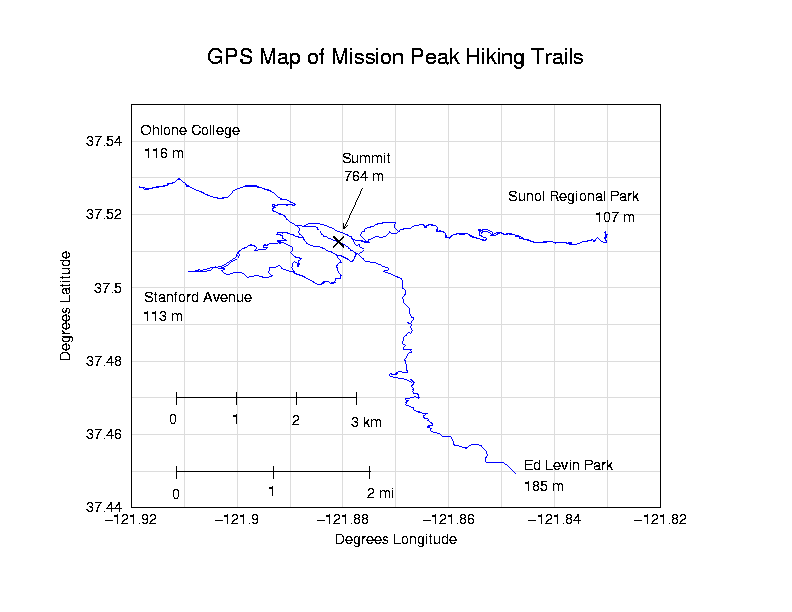
Here is a map of the trails on Mission Peak, a popular hiking spot in Fremont, CA. The map was made from the GPS tracklogs of separate hikes up to the summit from the Sunol, Stanford Avenue, Ohlone and Ed Levin trailheads. The map scales apply for both the horizontal and vertical directions as long as the bounding box for the plot remains square!